

I’m planning a fall trip to Sturgeon Bay in northeast Wisconsin to chase the legendary smallmouth roaming those Great Lake waters.
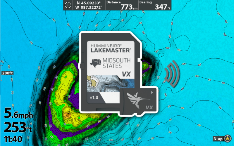
I needed a map card for the HELIX 12 MEGA+ SI unit I use at my console, and Lakemaster has the best mapping for Humminbird units. I had heard new Lakemaster VX cards were released recently, so I bought a Premium VX map card.
I’ve included 50 screenshots in this review to help you determine if it’s worth upgrading the maps on your boat.
No products found.
What is Lakemaster VX?
Lakemaster VX is the latest generation of map charts exclusively for Humminbird fish finders. VX charts promise better performance and more customization than older (legacy) map cards.
The new cards utilize “VX Technology” – a “vector accelerated technology” that promises to create highly detailed and customizable maps.
When I hear the word vector, it makes me think of vector graphics. Vector graphic images can be scaled larger or smaller without degrading image quality.
Sounds like an excellent idea for lake maps!
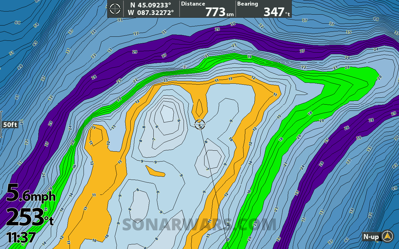
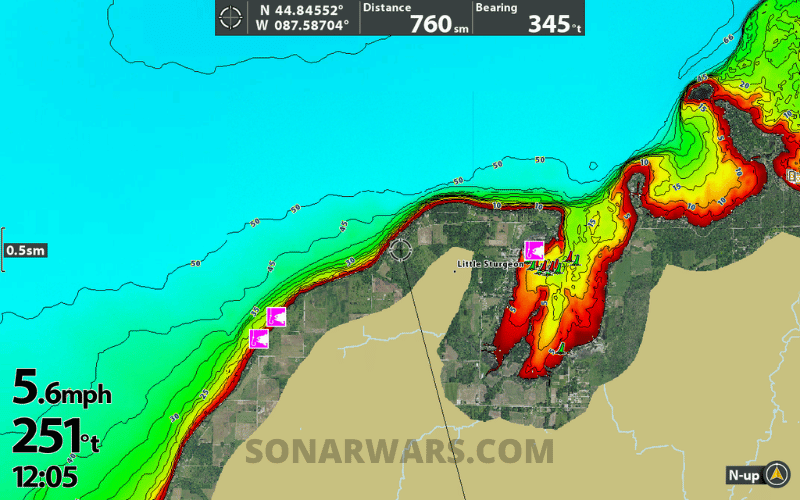
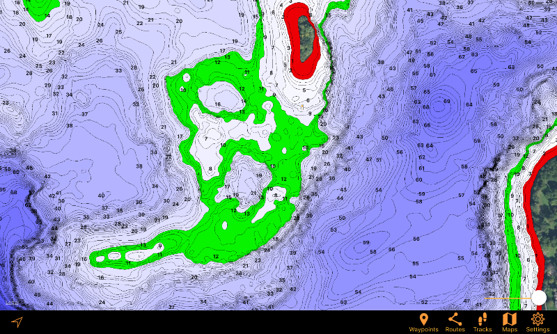
Anglers understand an excellent contour map is essential to breaking down water quickly. Locating the reefs, humps, points, flats, and ledges is crucial to success on new bodies of water.
Lakemaster maps have always been very good at this, with high-definition 1-foot contours and the depth range highlighting especially useful.
Lakemaster VX charts promise to be another stride forward in fishing electronics mapping.
LakeMaster VX vs VX Premium
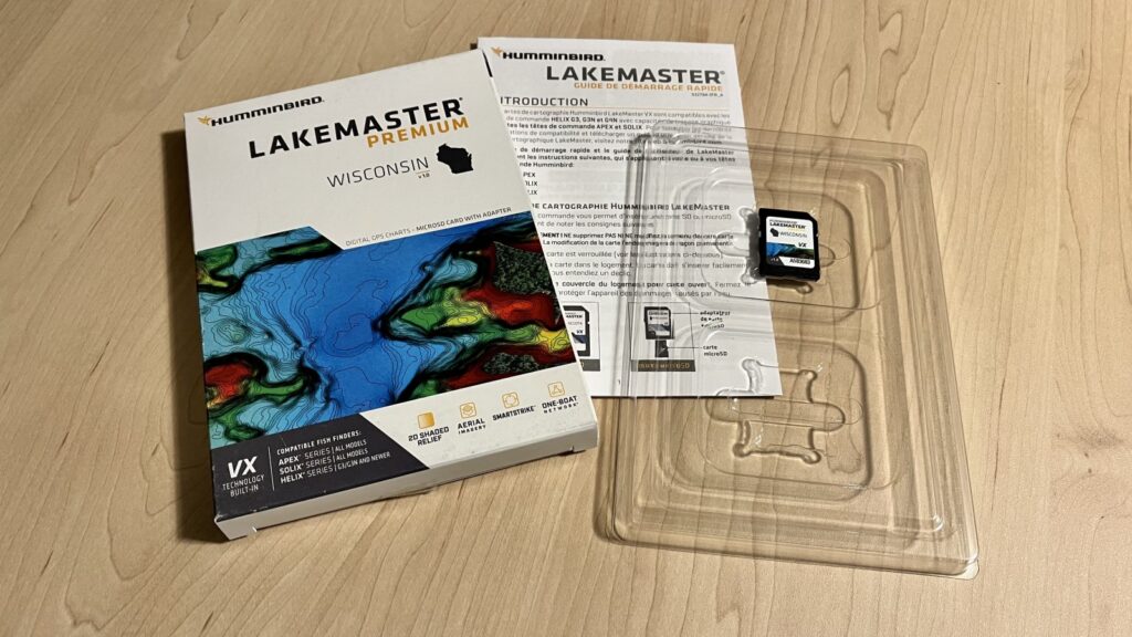
Previous Lakemaster map cards had multiple versions – a standard chart card, Smart Strike, and a premium Plus version with Aerial Imagery. These are now called Legacy charts.
VX cards have been consolidated into two versions, Lakemaster VX, and Lakemaster Premium VX. Both are the same price as the Legacy cards, but now with Smart Strike built into them all.
Note: Version numbers have been reset to 1.0 with the release of VX.
Premium VX adds Aerial Imagery overlays and 2D Shaded Relief modes. Keep reading to see what this looks like and if it’s worth the additional cost.
Shaded relief creates the appearance of depth and 3D terrain on a 2D map. It looks great on land maps and should look amazing on the fish finders.
Here is a complete list of the VX Features:
| Feature: | Lakemaster Premium VX | Lakemaster VX |
|---|---|---|
| VX Technology | ✅ | ✅ |
| 2D Shaded Relief | ✅ | ⛔ |
| Aerial Imagery | ✅ | ⛔ |
| Smart Strike | ✅ | ✅ |
| Chart Presets (3) | ✅ | ✅ |
| Depth Highlights (4) | ✅ | ✅ |
| Shallow Highlight (1) | ✅ | ✅ |
| Water Level Offset | ✅ | ✅ |
| Buy at: | Bass Pro | Bass Pro |
| Buy at: | Amazon | Amazon |
VX Technology
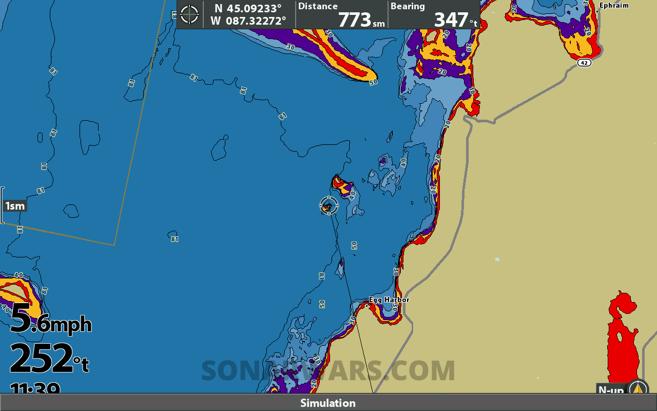
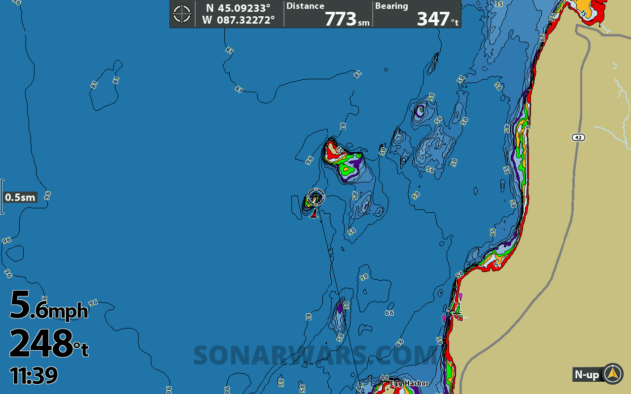
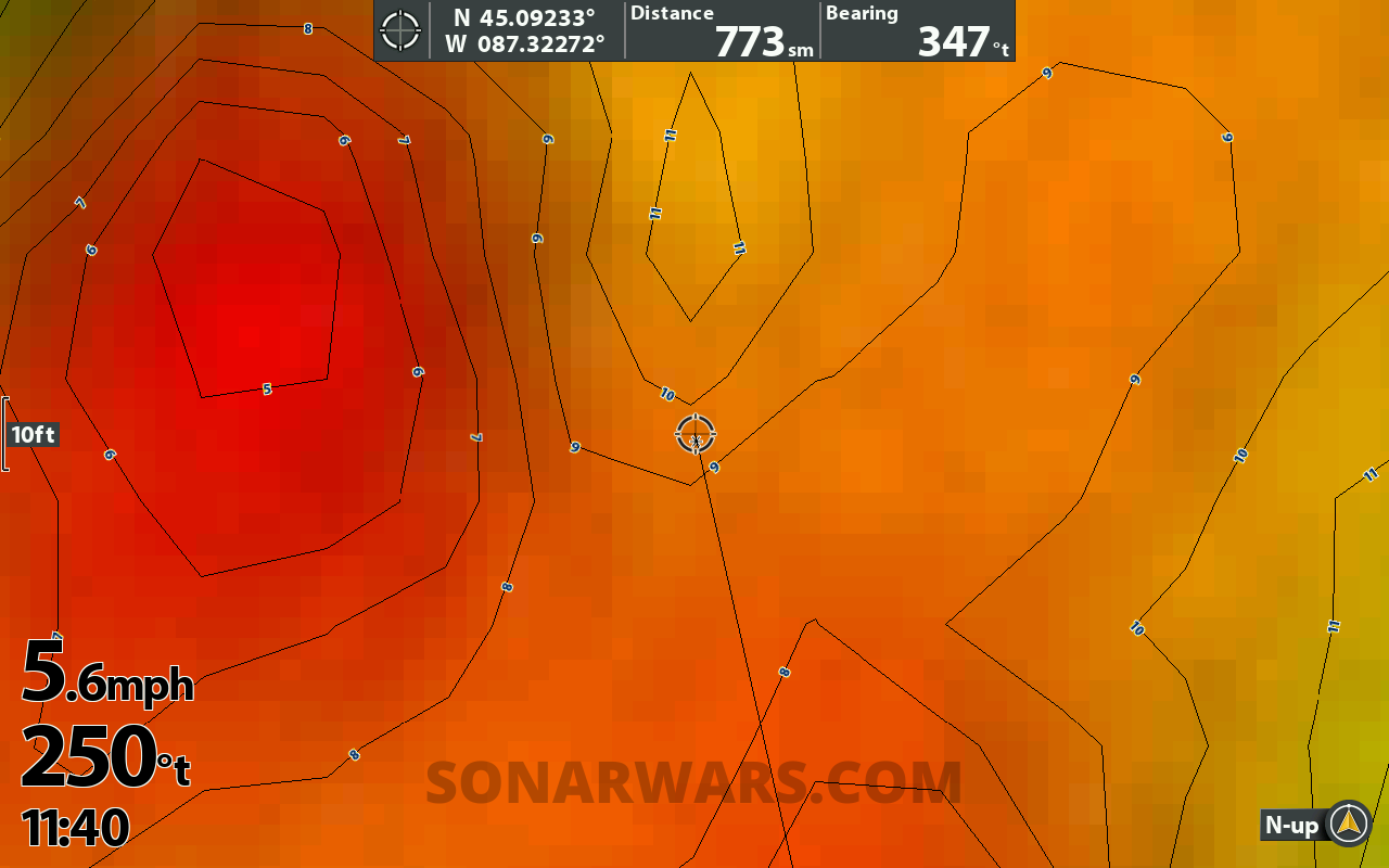
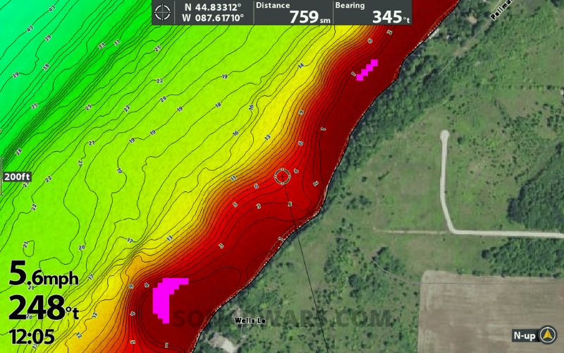
Having explored the new maps parked in the garage for several hours, I can say the contours generated by the “vector accelerated technology” look great.
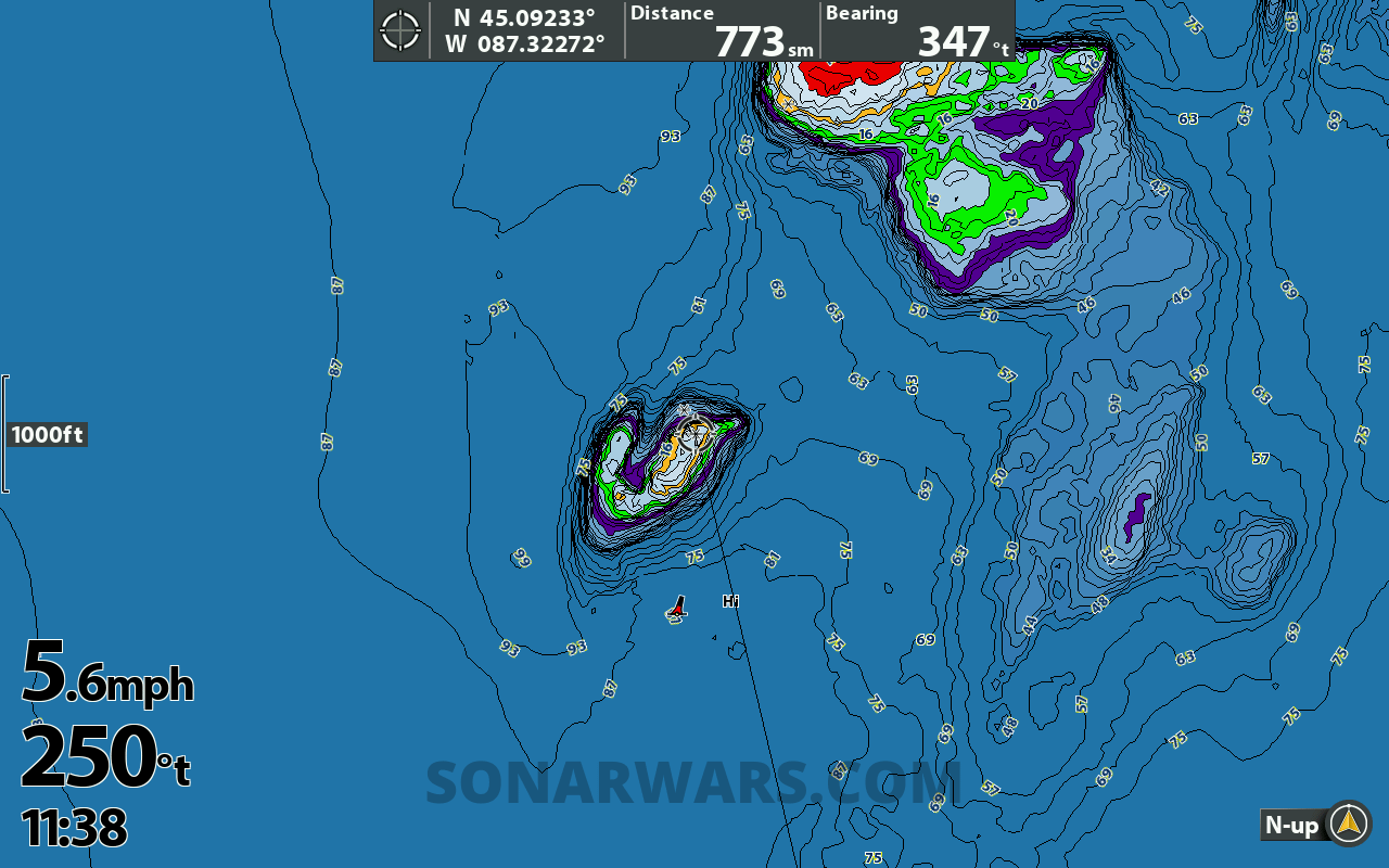
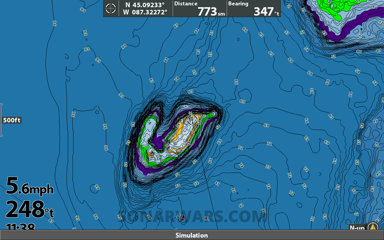
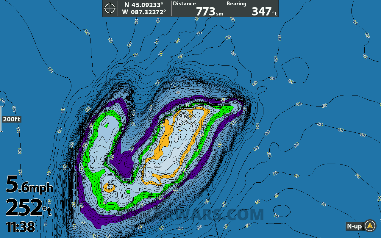
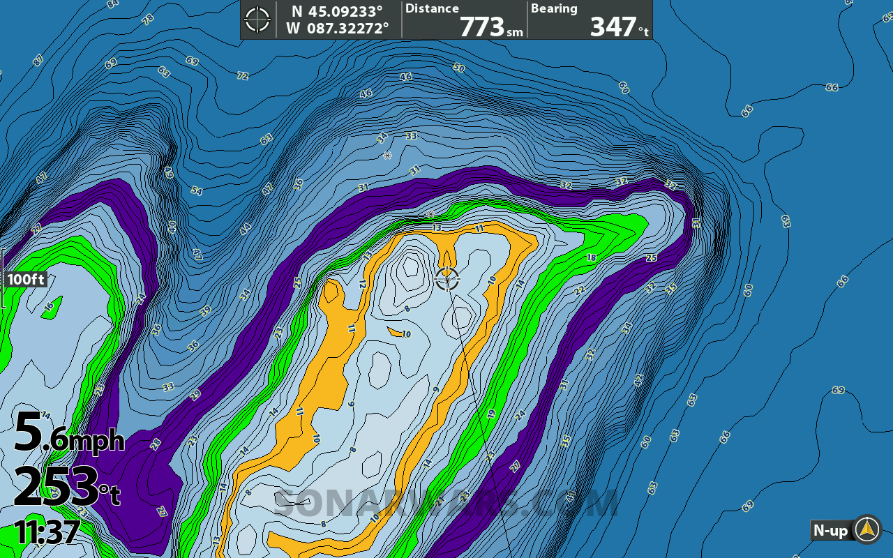
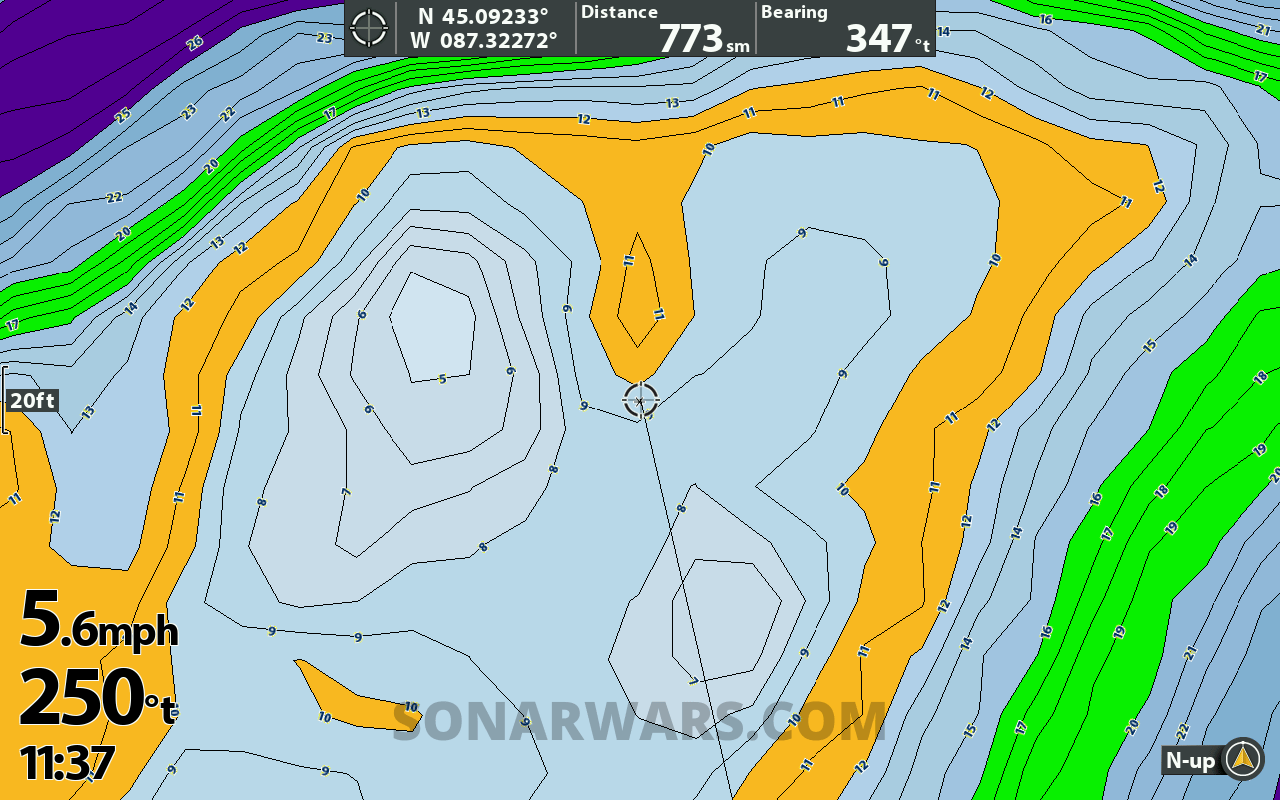
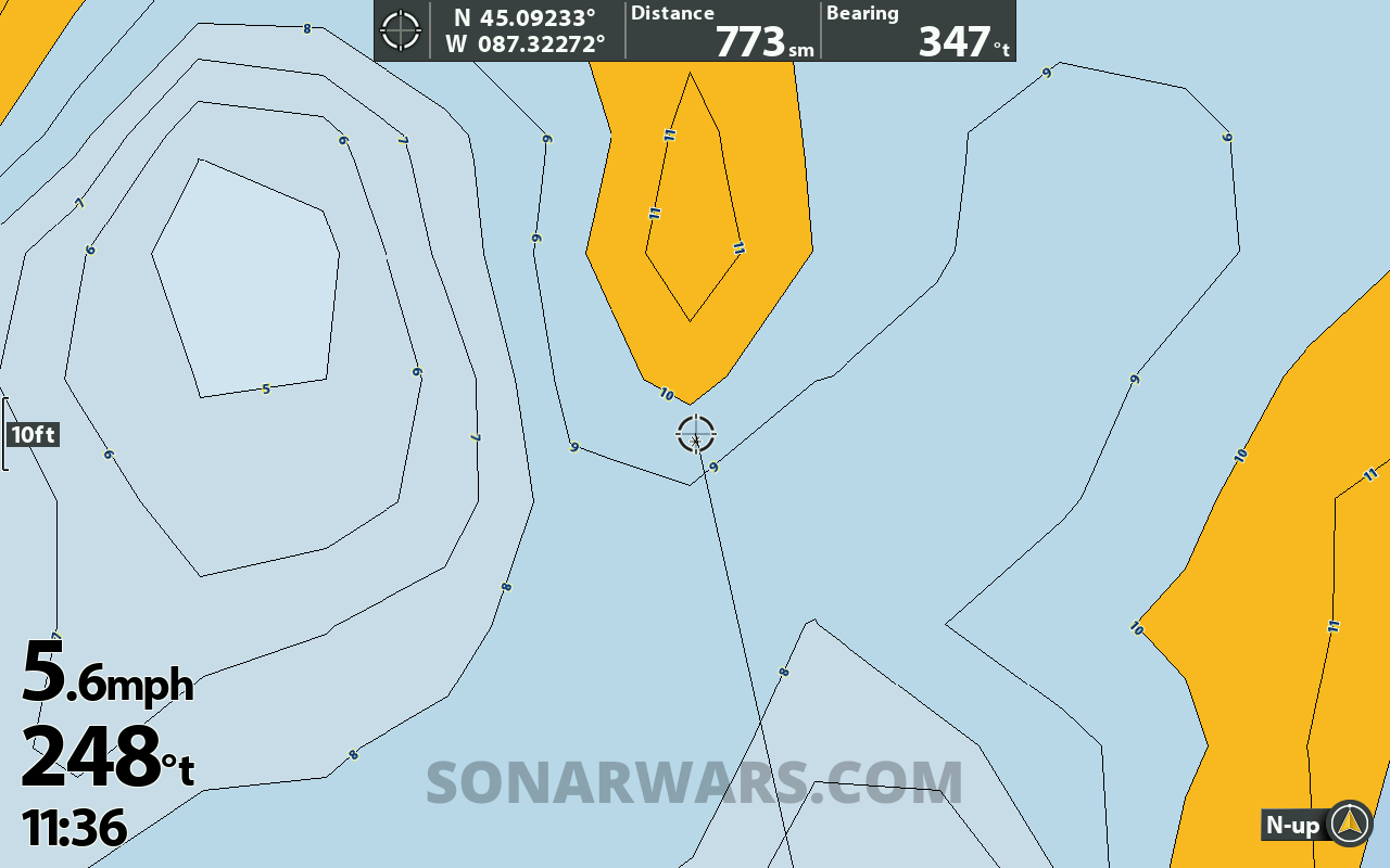
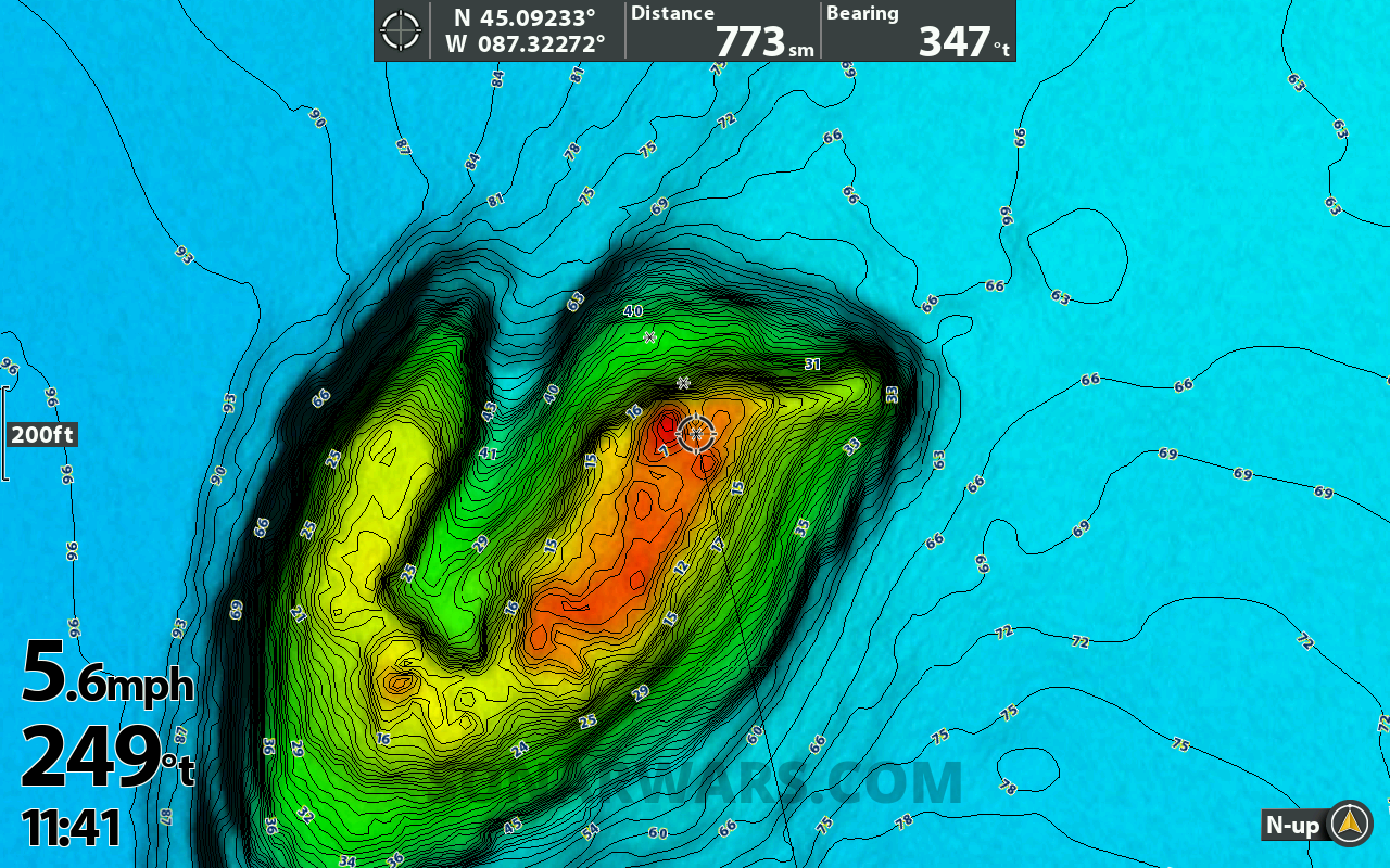
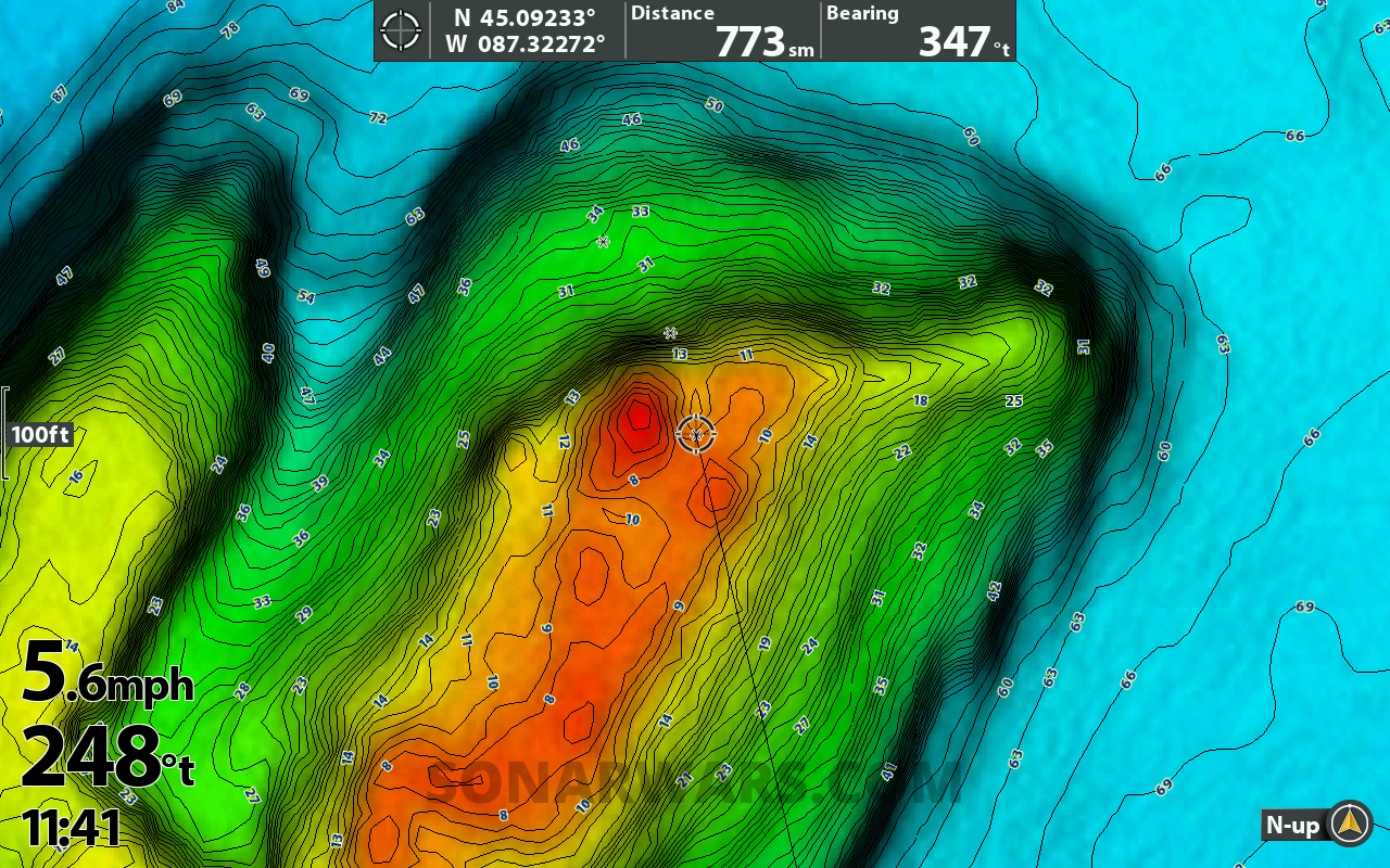
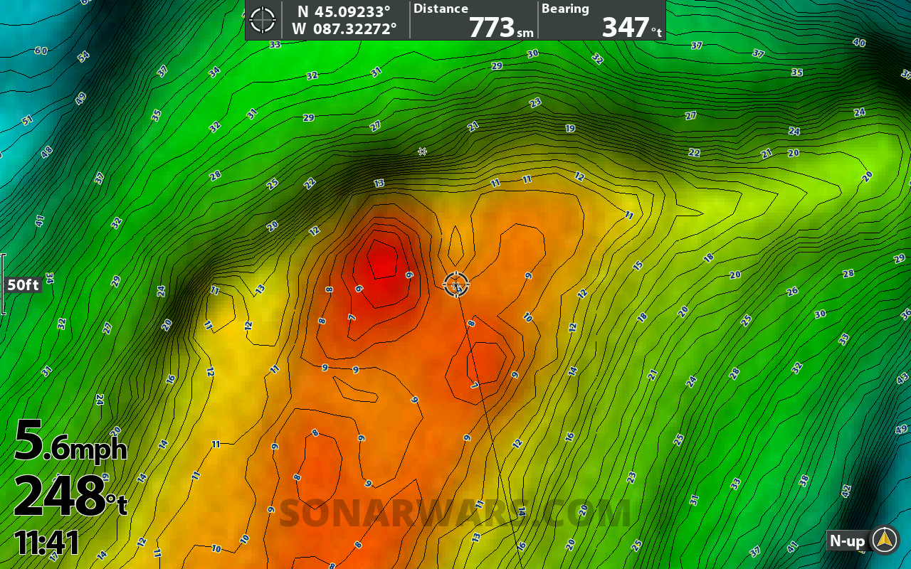
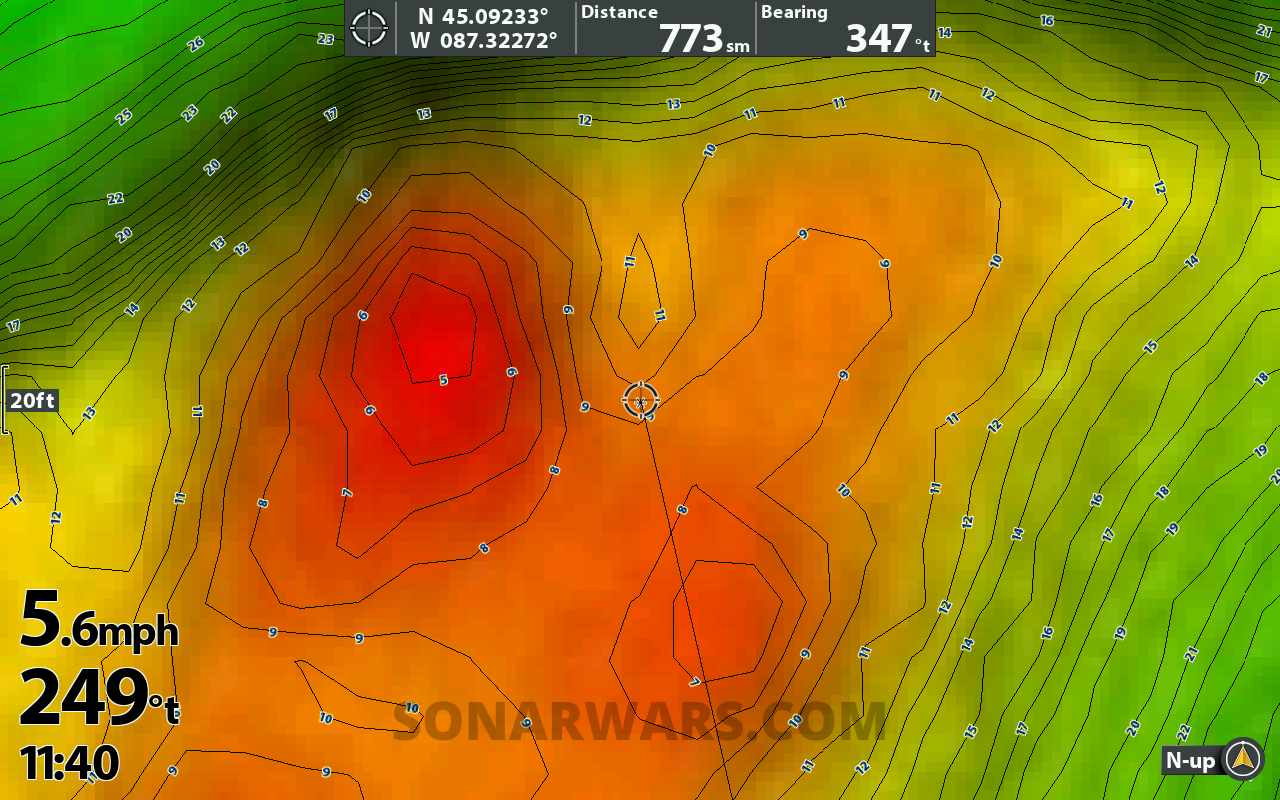
It’s not a dramatic change, but they look smoother, especially in 100ft and under zoom range. Legacy maps got very pixelated in the 50-foot zoom and were not helpful.
I also noticed a performance improvement on the Helix. The charts seemed to draw and refresh quicker when moving the cursor across a lake.
Here are screenshots showing the contour lines from 1 mile zoomed down to 10 feet. You’ll notice the contours are decluttered to start, gaining detail as we zoom in.
Image Gallery: Swipe or Use Arrows to View All

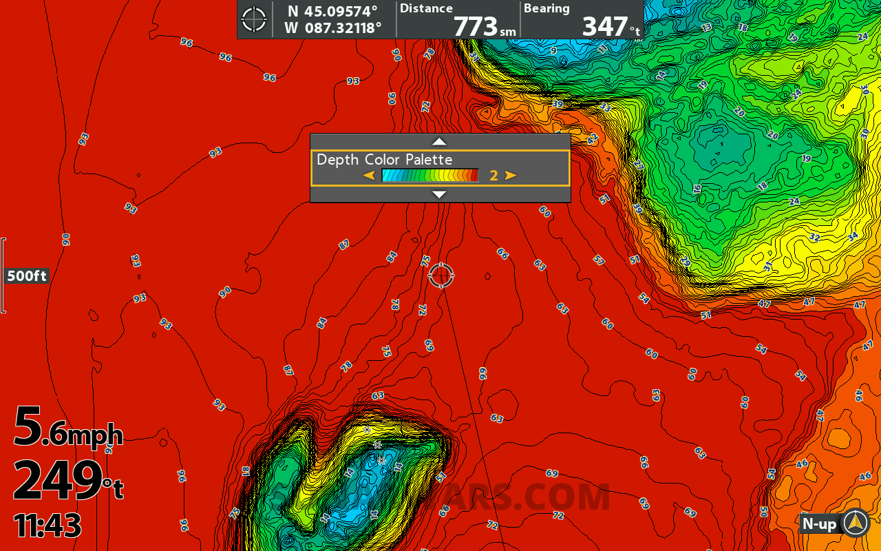
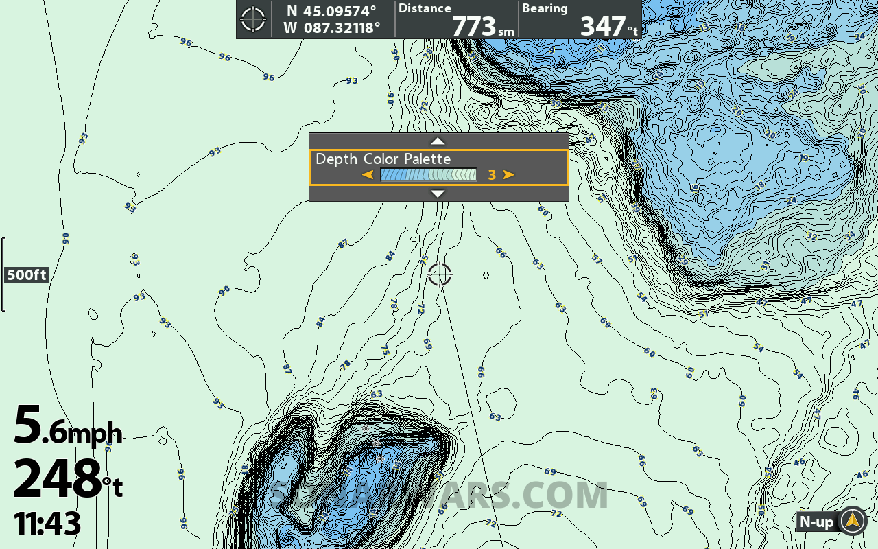
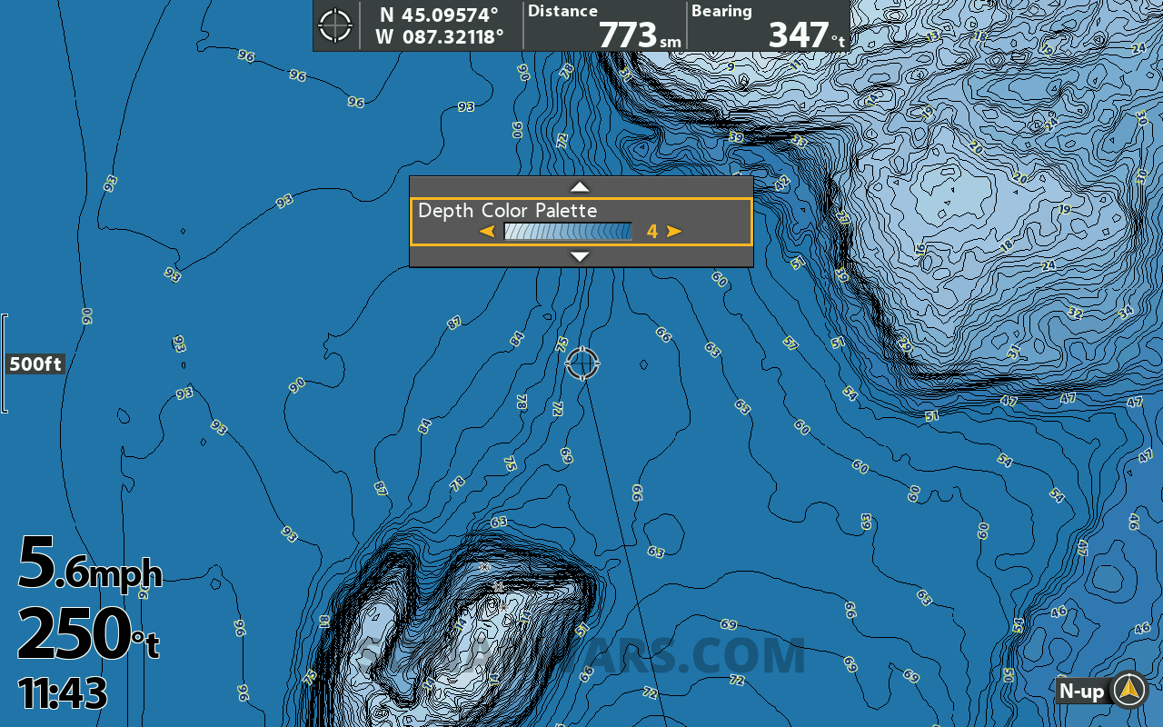
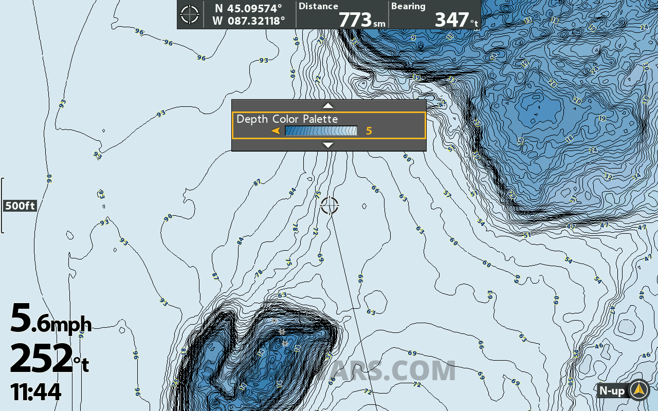
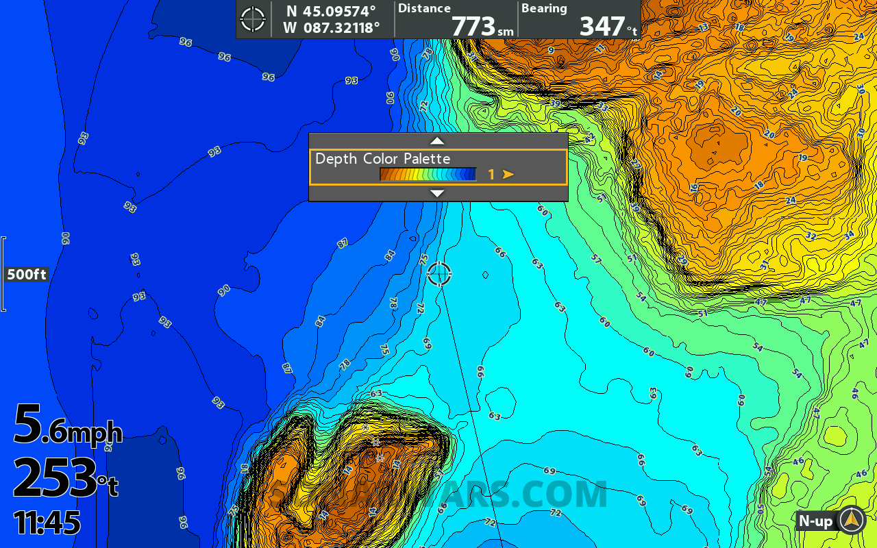
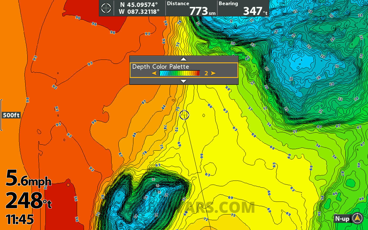
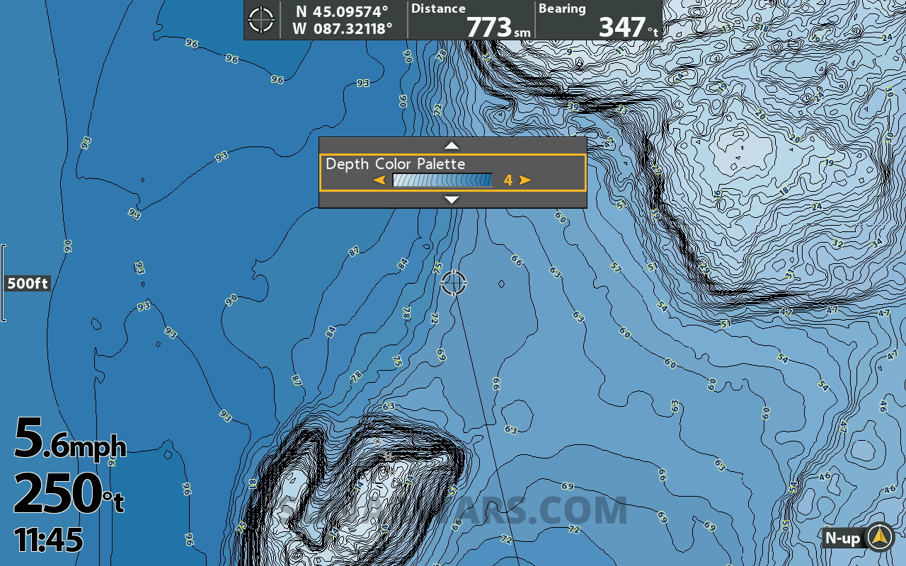
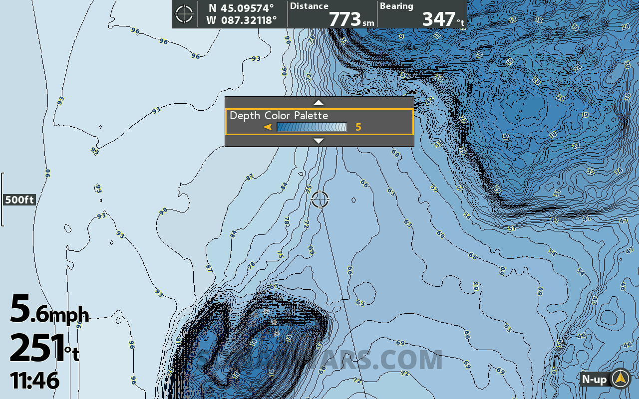
New Color Palettes
On previous cards, there was only one color palette with four shade selections to control the shade of blue. VX has 5 all-new color schemes and controls for the number and depth of blues.
Which do you like best? My Fishing preset will probably use 3 and 4 with depth highlights.
Image Gallery: Swipe or Use Arrows to View All

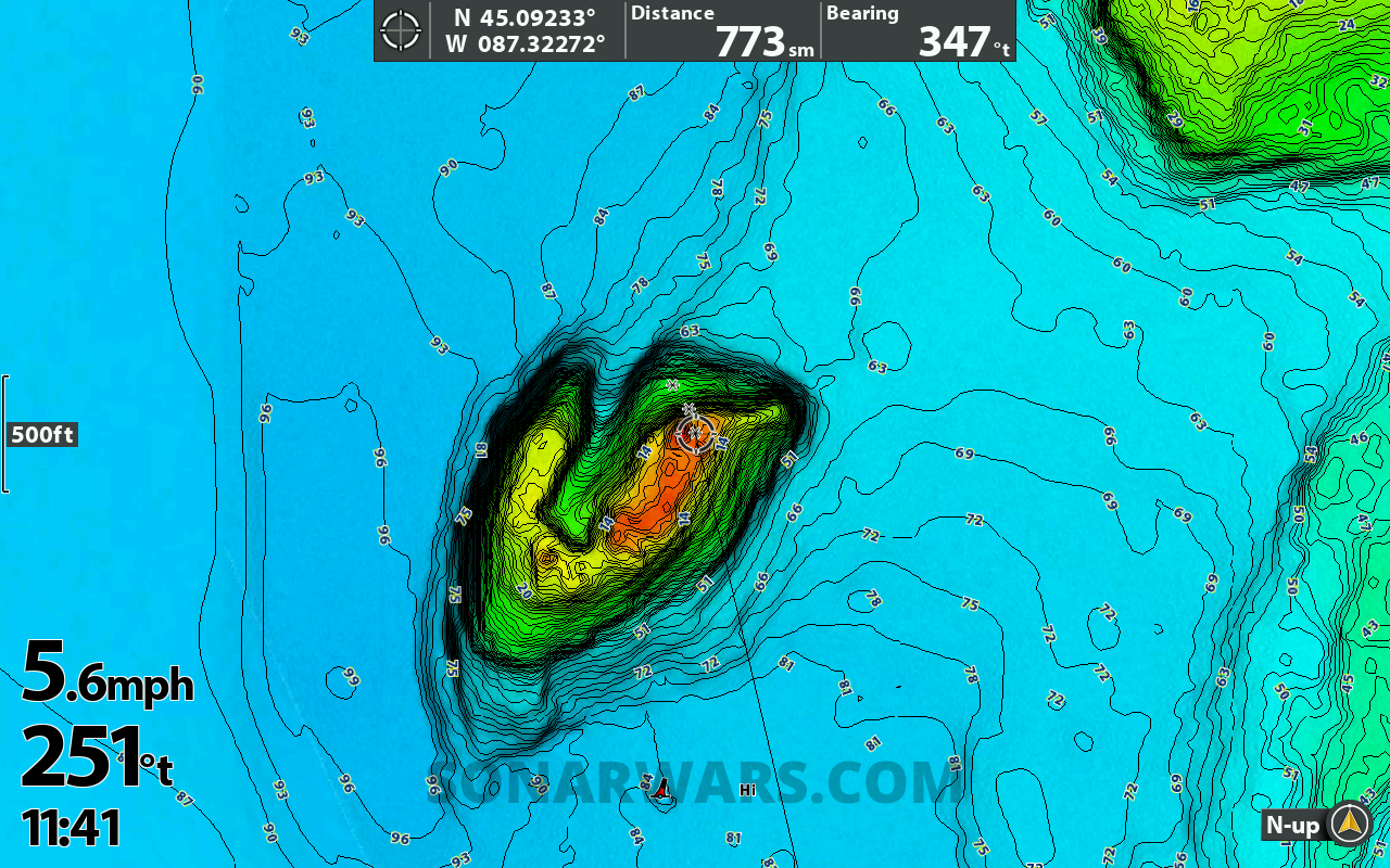
2D Shaded Relief
The shaded relief overlay looks excellent, combined with the contour lines and even with aerial imagery. I did get a sense of 3D depth that regular contours can’t provide.
There is only one color palette on this layer, and selecting Shaded Relief overrides whichever standard color palette was selected. But – you can display depth range highlights over the shaded relief layer.
It would be worth having one Premium VX card at the console for map study and a regular Lakemaster VX at the bow. I don’t see a need for it fishing from the bow.
Here are screenshots with shaded relief activated, from 1 mile out zoomed down to 10 feet.
Image Gallery: Swipe or Use Arrows to View All
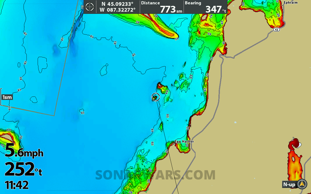
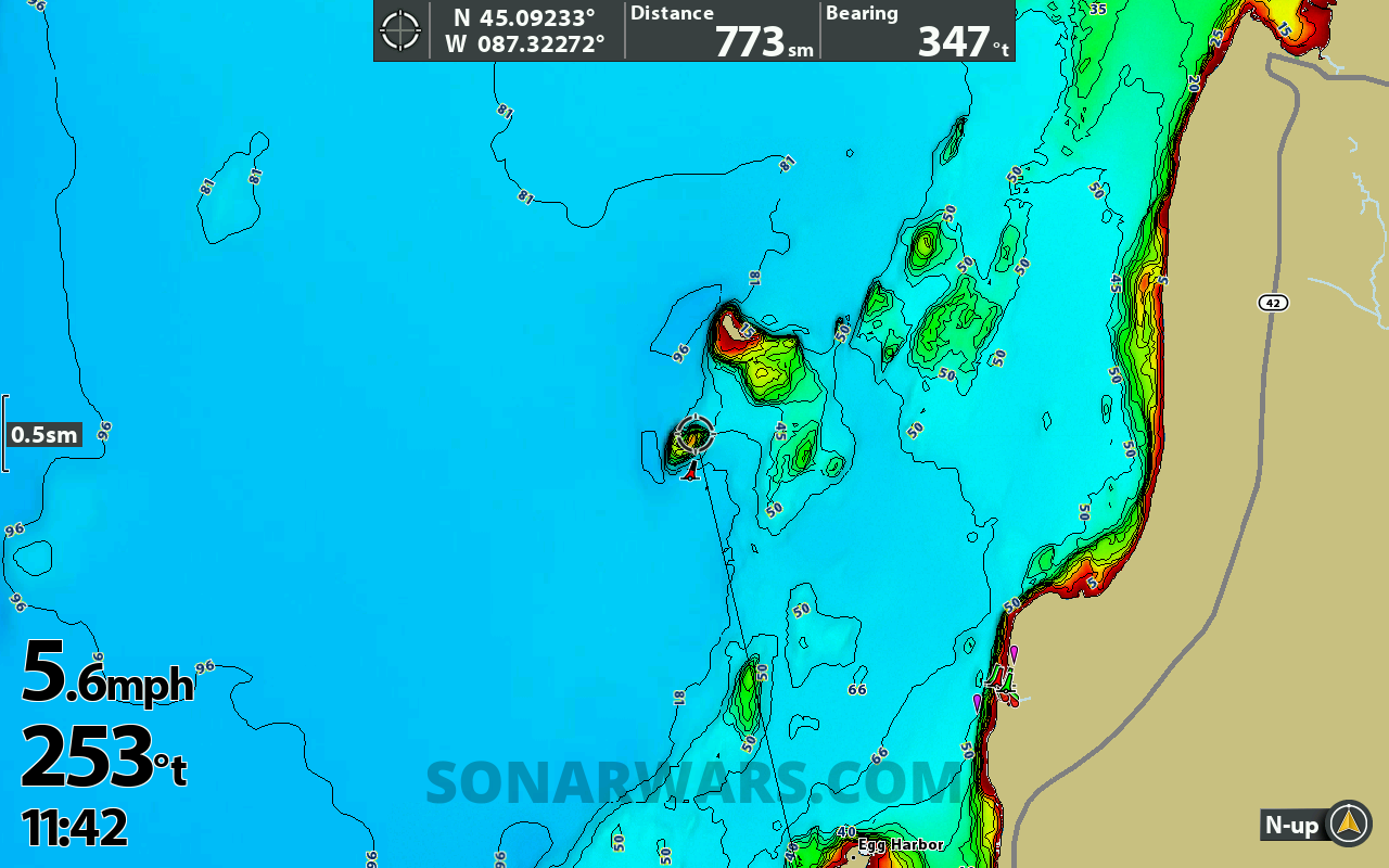


Aerial Imagery
This layer will be familiar to anyone with a legacy Lakemaster Plus card. Turn this layer on to see shoreline features, docks, marinas, and offshore vegetation. This feature is only available on the Lakemaster VX Premium charts.
You can select Land or Land+Water in the Layers menu. The Land only mode will show aerial images from the shoreline out, while Land+Water adds a swath of aerials inward from shore.
I find it best to adjust the transparency of this layer to 50-75%, so it doesn’t overpower the regular color palette.
Image Gallery: Swipe or Use Arrows to View All
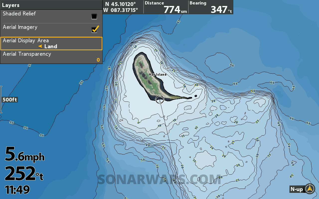
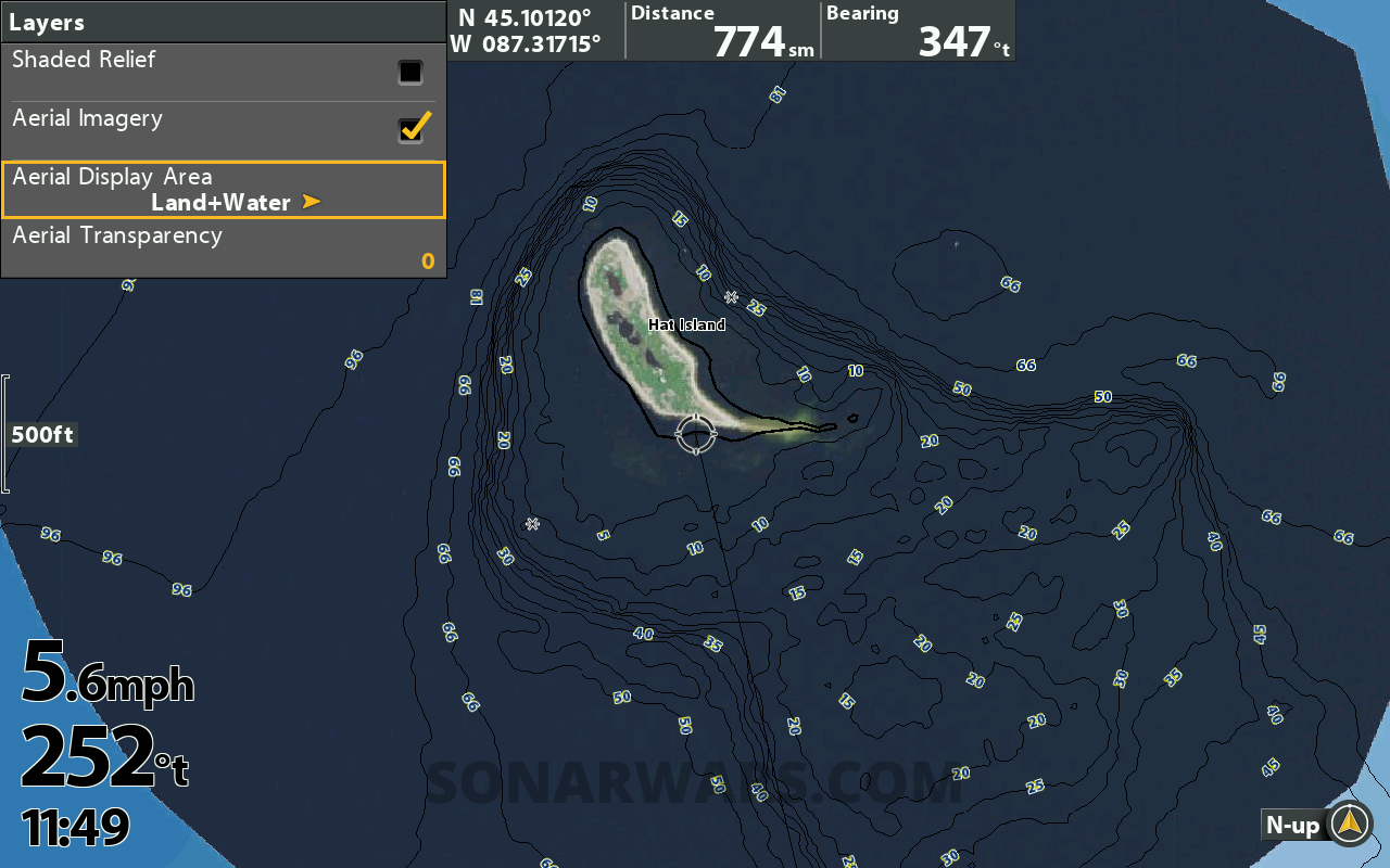
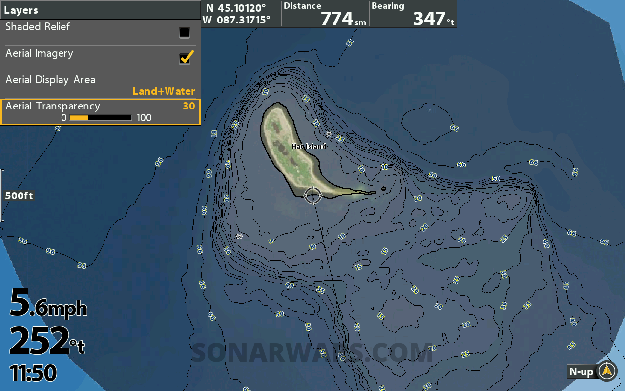
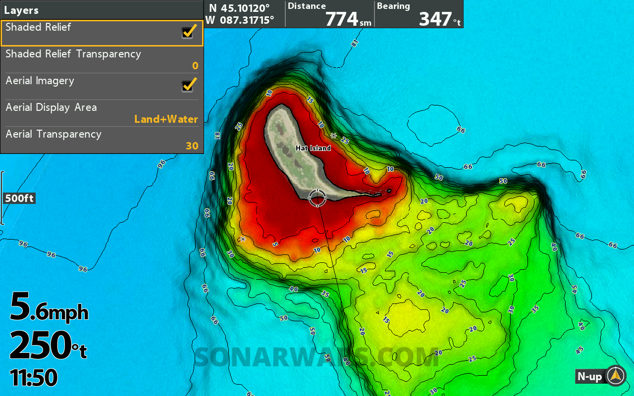
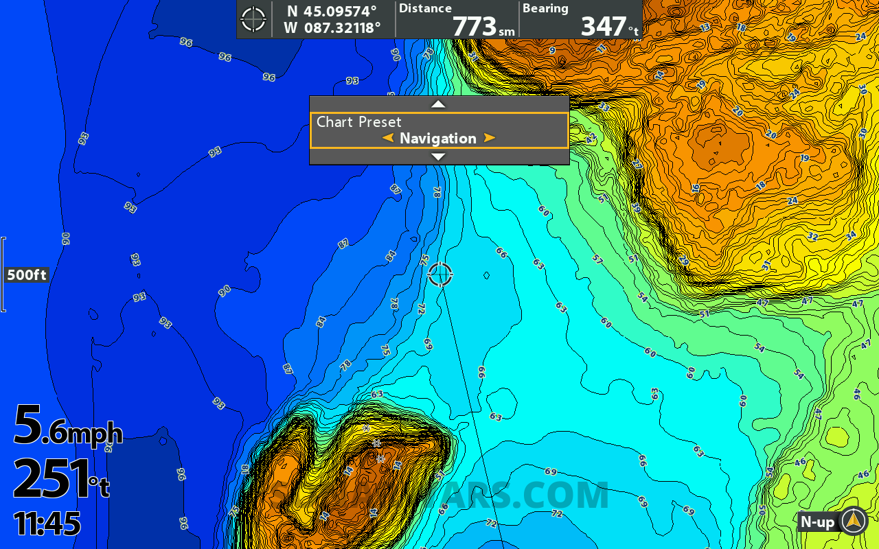
Chart Presets
With so many customizations, making changes to your chart can become overwhelming. Chart Presets (Fishing, Navigation, and User) let you fully customize each preset however you want.
For example, depending on whether I am fishing or driving the boat, I might want different depth highlights. This can quickly be changed by switching from the “Fishing” to the “Navigation” preset. Then if you want to study the map in Shaded Relief, you could set that to the “User” preset.
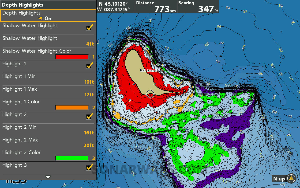
Depth Highlight
All Lakemaster VX maps can now display up to four customizable depth ranges simultaneously, compared to the one on legacy charts.
Below is a screenshot showing four depth highlights at once. Each highlight can have one of 8 different color options. Red, Blue, Cyan, Green, Orange, Pink, Purple, and Yellow.
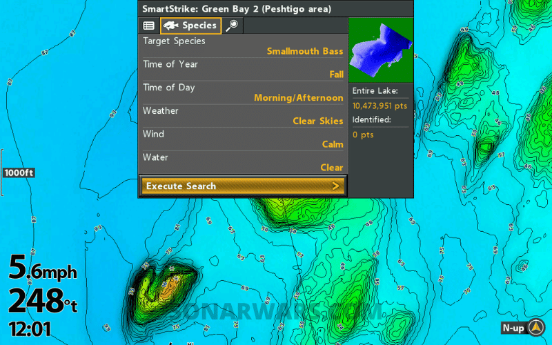
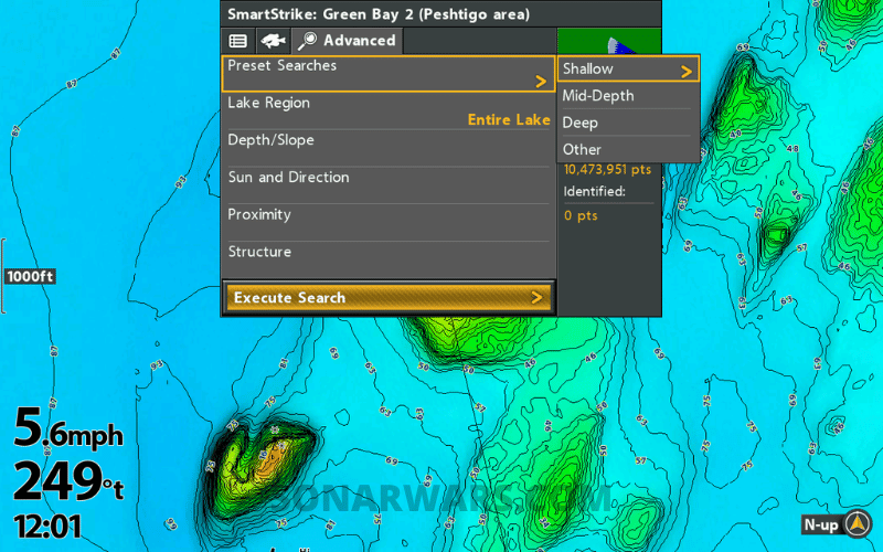
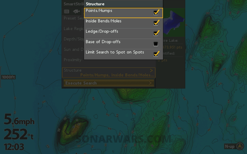
Smart Strike
SmartStrike is a built-in app that uses predictive fishing tips based on conditions you input. It may sound a bit cheesy, but everyone has tough days, and I’ll take help when I need it.
I’ve used SmartStrike on legacy LakeMaster before, and it always felt slow and buggy. The VX SmartStrike was fast and flawless each time I ran it.
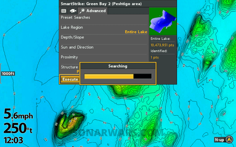
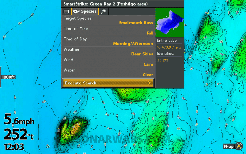
You select the body of water, enter the current conditions, and select the target species. It’s even possible to narrow the output to specific types of structure and proximity to other features.
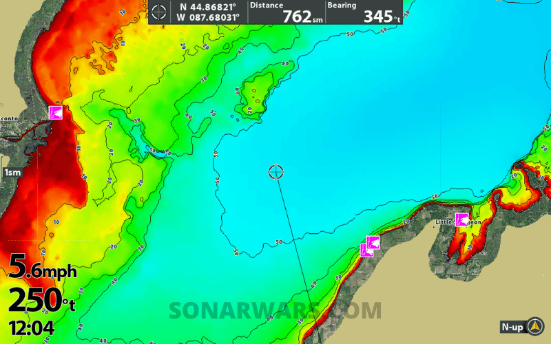
With the inputs selected, run the algorithm, and SmartStrike outputs possible fishing locations. In the screenshots below, the tool narrowed down 10,000,000 possible locations to just 35 based on my selections.
Image Gallery: Swipe or Use Arrows to View All


Shallow Water Highlight
This is a standard feature for LakeMaster, which adds a color highlight to the selected depth range. You can set this from 0 to 60 feet.
Water Level Offset
Use this setting to instantly raise or drop the water level onscreen to match current lake levels. This feature is helpful if you fish in reservoirs or rivers with fluctuating water levels.
Here are screenshots showing how the land extends out automatically when changing Water Level Offset to -5ft and -10ft, respectively. Notice the depth range highlights shift automatically with the offset.


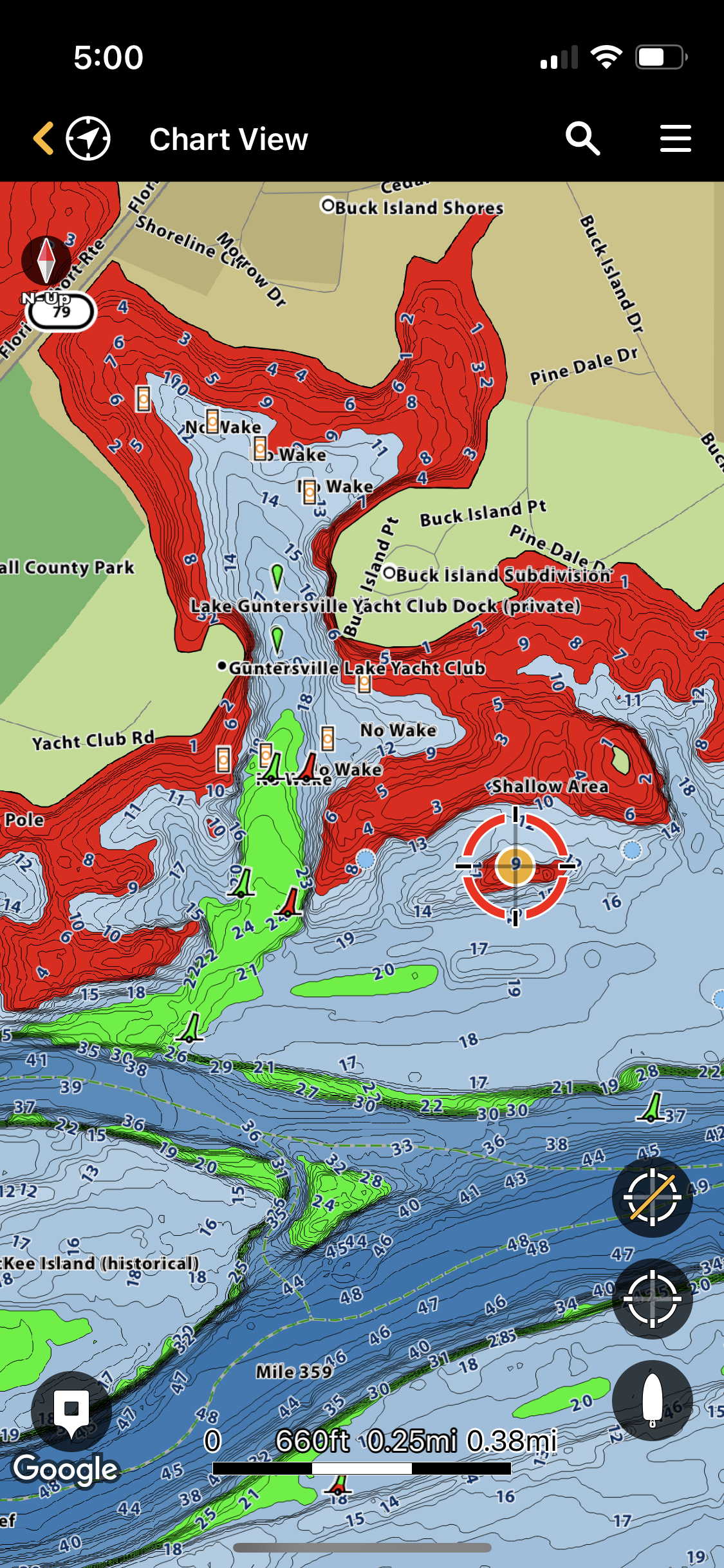
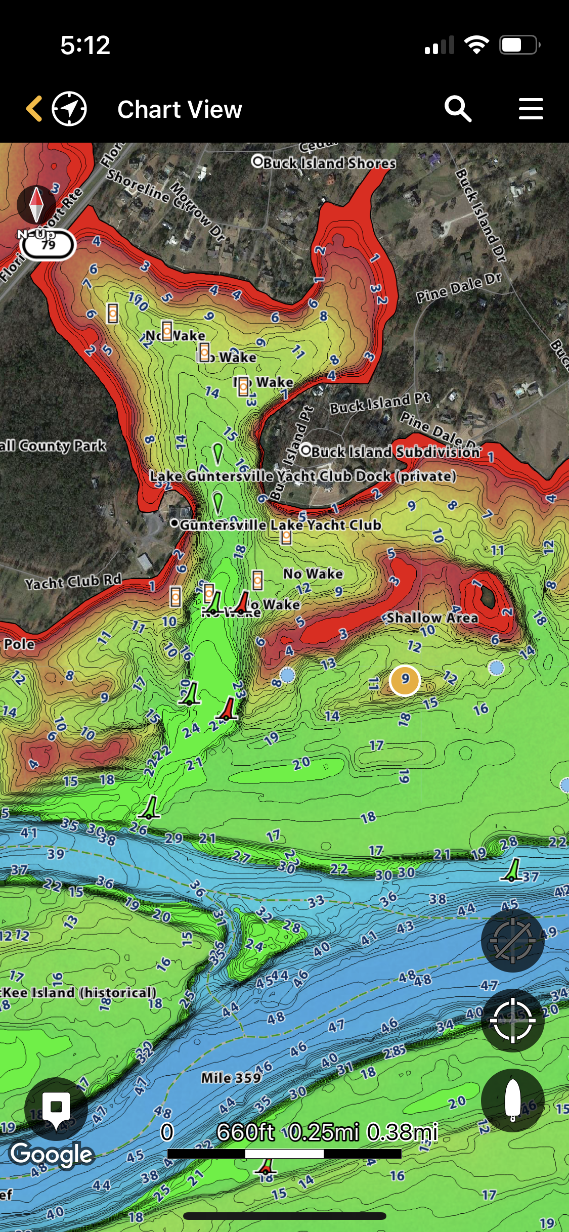
One-Boat Network App
This app connects all your Humminbird, Minn Kota, and Cannon electronics. You can use the Chart View to scroll around the Humminbird Basemap, but downloading VX charts to the app is the real win.
Go to My Charts, then Enter a Coupon Code. Check your LakeMaster box for a postcard-sized voucher with a code to give you 1 year of LakeMaster VX charts on your device. After the year mark, you can resubscribe for $24.99 per year.
After entering the code, use the map to select squares on the grid and download the charts. This will take a few minutes. Then you go back to Chart View, and boom; your VX maps are viewable on your mobile device!
The best part? It’s all the US and Canada with the One-Boat Network chart viewer, not just the region you purchased. Awesome!
Here are screenshots of what the VX map of Lake Guntersville, Alabama, looks like on a mobile phone.
Compatibility
LakeMaster VX and Premium VX are compatible with the following Humminbird models. You should also update the latest software before using your new map card.
- Helix G3/G3N
- Helix G4/G4N
- ICE Helix G3/G3N and newer
- All Solix
- All Apex
Coverage – Regions and Lake Lists
VX charts are available for these regions. Check out the complete lake lists here.
| Minnesota | Mid Atlantic | Great Plains |
| Wisconsin | Mid South | Western States |
| Dakotas + Nebraska | Southeast | Ontario |
| Great Lakes | Louisianna Delta | Manitoba |
| Quebec |
Review Summary
The LakeMaster VX Premium maps are a nice upgrade from the legacy charts. I found the maps smoother, faster, and more customizable than before.
Everything you like about LakeMaster is now better on the VX charts.
Now is a great time to pick up a new chip for your Humminbird. Buy one at your preferred retailer:
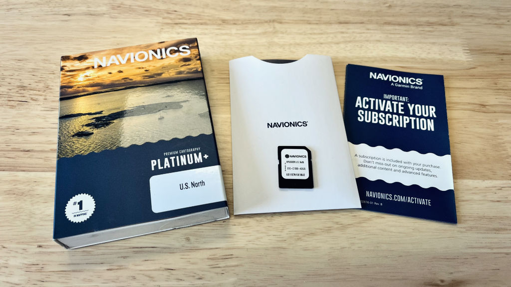
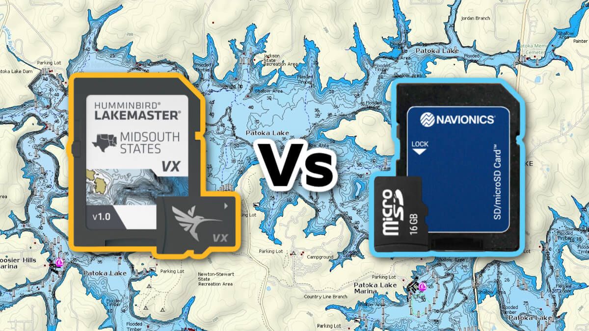
You might want also to compare LakeMaster VX with Navionics+. The two mapping chips offer similar capabilities, and I was surprised by how good Navionics coverage and quality are on a Humminbird unit.
*Last updated 2026-07-28 at 16:01 / Product Links & Images from Amazon Product Advertising API
Leave a reply