


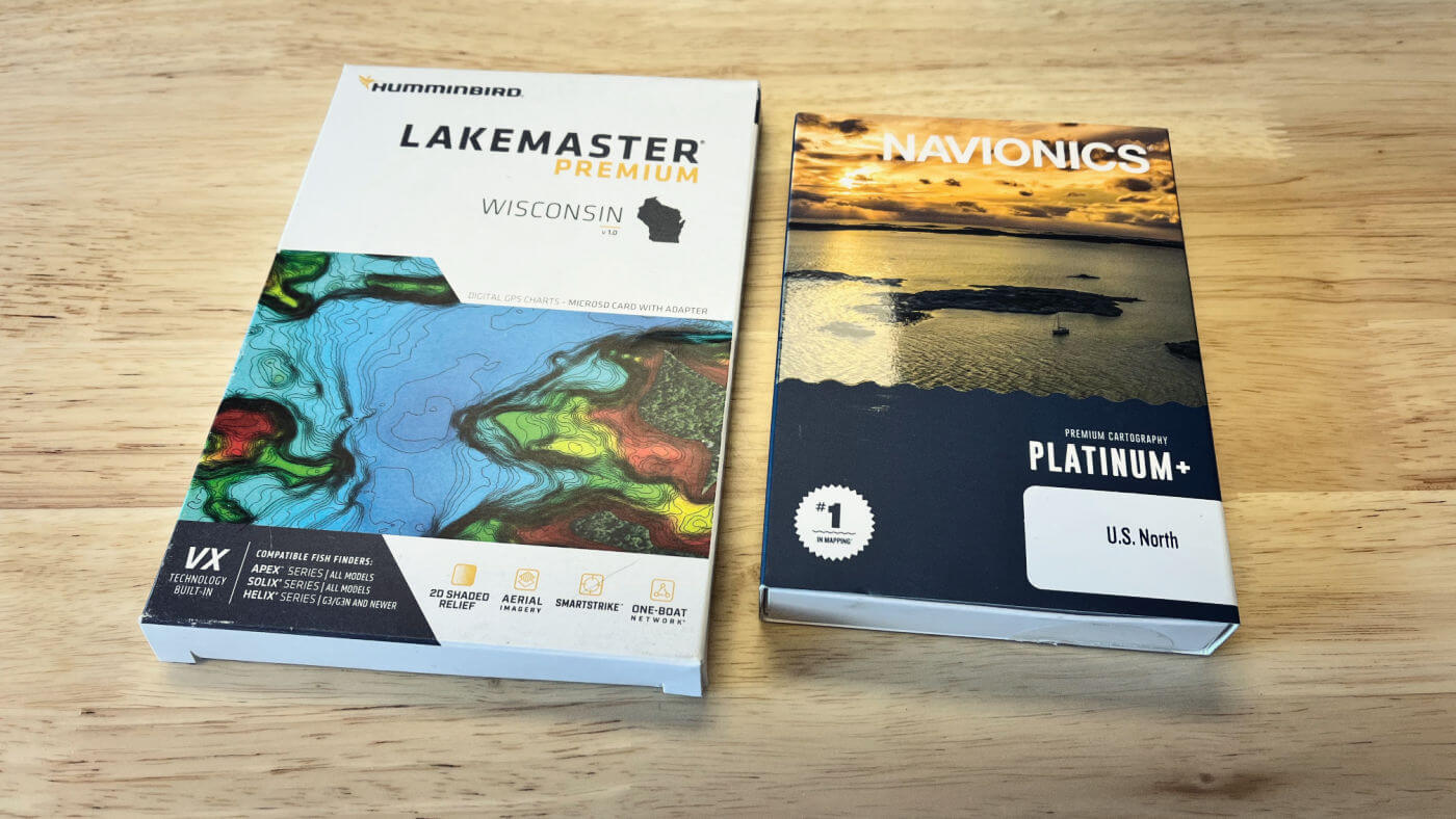
If you just bought a Humminbird and are looking for the best lake mapping, you can choose between LakeMaster and Navionics charts.
LakeMaster works exclusively with Humminbird units, while Navionics still offers products for other fish finder brands (for now), even after being bought out by Garmin.
LakeMaster VX cards are the best choice for Humminbird owners in most cases, enabling all the capabilities of your unit and the excellent HD contour details. However, Navionics has more coverage – if you fish in certain states in the Midwest, Navionics+, and Platinum+ maps are also great and could be the better choice.
For example, if you fish both Michigan and Wisconsin waters, you would need to buy both the Great Lakes and Wisconsin cards while you only need the US North & Great Lakes product.
The rest of this article dives deep into the capabilities of each brand and breaks down the coverage differences and oddities to help you buy the best maps for your Humminbird fish finder.
Company Facts
LakeMaster works exclusively with Humminbird units, while Navionics still offers products for other fish finder brands (for now), even after being bought out by Garmin. Here is a quick overview of each brand.
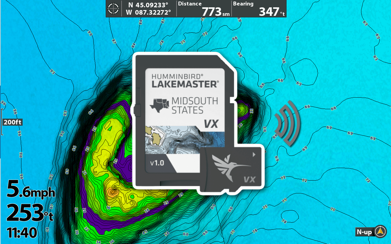
LakeMaster
Founded in 1992 by Mike Wood, located in Little Falls, MN. Acquired by Johnson Outdoors in 2011. Made their name in the Midwest and with High-Def paper maps.
Navionics
Founded in 1984 and located in Viareggio, Italy. The company started with European mapping before expansion to North America. Acquired by Garmin in 2017.
Pros & Cons Overview
Here are the main points to consider in this Navionics vs Lakemaster VX comparison. For those who want more details, read on, we dive into all of these points further in the article.
LakeMaster VX Premium
Read: LakeMaster VX Premium Review
PROS
CONS
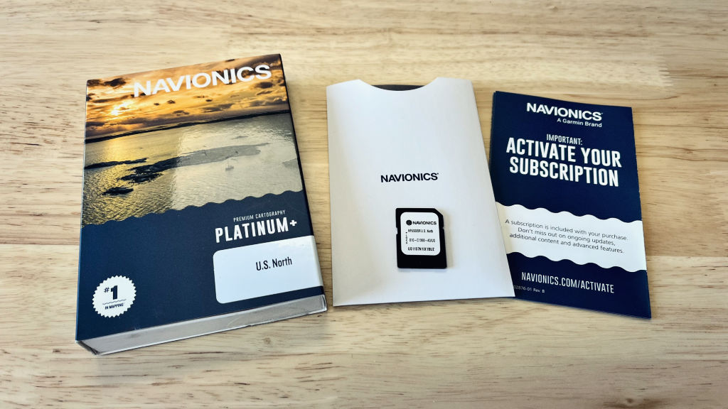
Navionics Platinum+
Read: Navionics Platinum+ Review
PROS
CONS
Navionics vs. LakeMaster Features
The first thing we need to do is compare the feature set of the two mapping products. LakeMaster VX and VX Premium cards go head-to-head with Navionics+ and Navionics Platinum+, respectively.
Note: If you see map cards named Garmin Navionics+ and Garmin Navionics Vision+, those cards are only compatible with Garmin units. Be aware it’s an easy mistake to make!
Here we compare the features of each card version. I highly recommend you study this chart closely and understand each before buying a mapping card!


*Chart updates are only available with an active subscription.
**Both products offer Mobile App subscriptions, but only Navionics requires the subscription to use the premium Satellite Imagery, SonarChart, 3D View, and Shaded Relief layers on your fish finder.
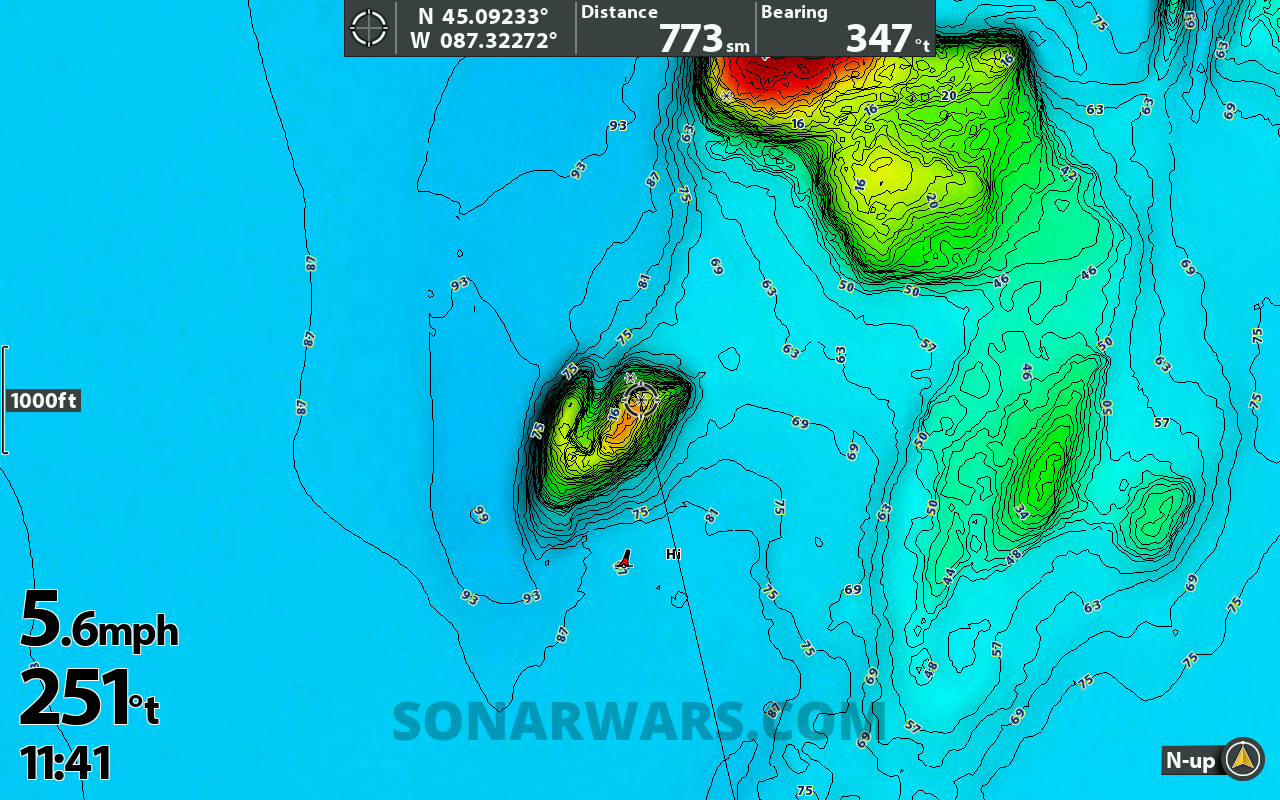
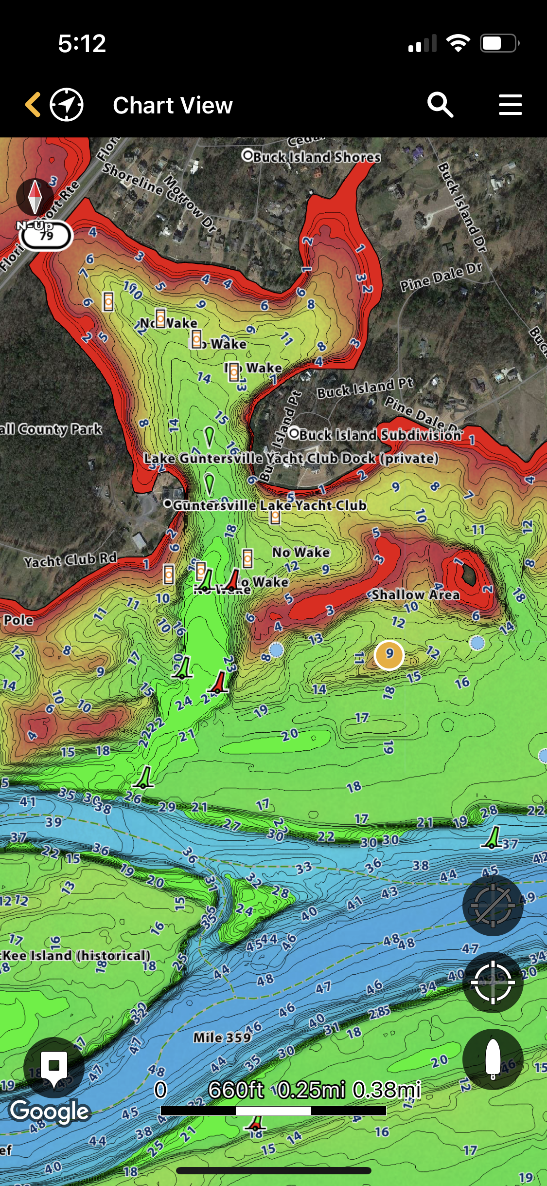
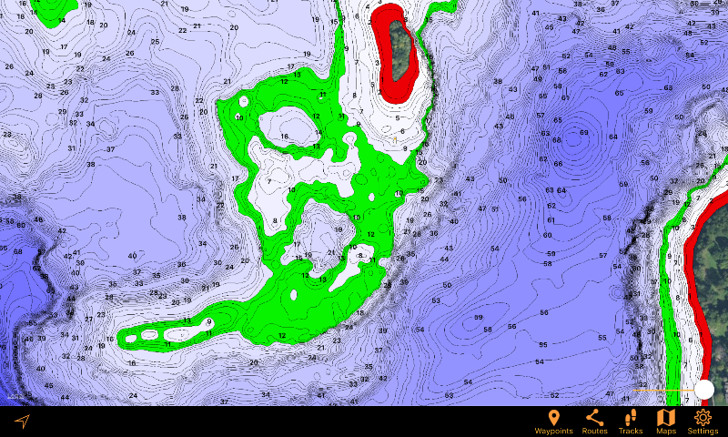
Contours
Both LakeMaster and Navionics offer charts with up to 1-foot contours. It is clear which lakes are high-def on the LakeMaster cards, but not at all clear for Navionics. Your best bet is to visit the Navionics Web App and check your favorite lakes for contour details.
LakeMaster coverage documentation also tells you which lakes have been surveyed by LakeMaster crews themselves and not relying on third-party data. Having recent surveys makes for more accurate lake maps.
Advantage: Even
Depth Highlighting
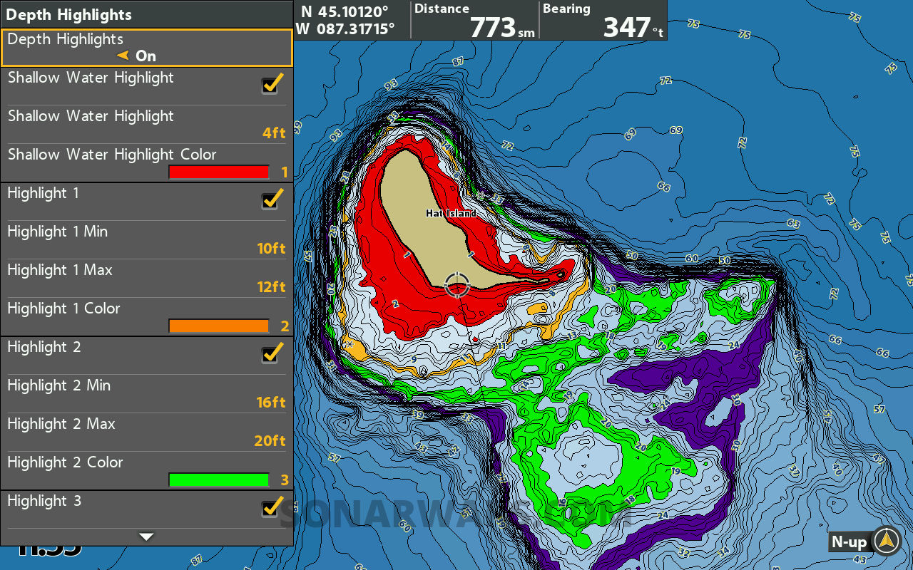
Highlighting depth ranges is super helpful on the water to identify possible fishing locations. Depth highlighting on Humminbird units is found exclusively with LakeMaster VX cards.
Shading shallow zones is great for safety and quickly finding shallow backwaters. VX cards allow you to highlight up to 4 depth ranges customizable to any zone you want.
Advantage: LakeMaster VX
Smart Strike
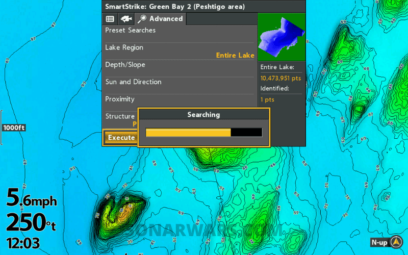
Another LakeMaster exclusive, this is a predictive fishing app built into every VX card. It won’t catch the fish for you, but it’s a nifty tool when times get tough on the water.
You enter your target species and select various conditions, depths, and structure to narrow down your search. The app crunches the data and plots likely spots for you to fish. It’s a fun deal to try, especially on unfamiliar waters.
Advantage: LakeMaster VX
Aerial & Satellite Imagery
Both the VX Premium and Platinum+ products offer Aerial/Satellite imagery. The difference is in the coverage.
LakeMaster has Aerial Images for all water bodies included on the card, while Navionics Platinum+ is much more limited in scope.
Navionics Satellite Overlays tend to cover only the most popular lakes and reservoirs. Venture outside of those, and there are vast dead spots with no imagery available.
You will also have to download the imagery to the Platinum+ SD card while it’s already pre-loaded onto every VX Premium card.
Advantage: LakeMaster VX Premium
Relief Shading
Relief Shading is a new feature for LakeMaster. It is used on maps to create the illusion of depth in a two-dimensional view. For fishing and boating, it helps underwater features stand out and highlight subtle contour changes.
As with Satellite Imagery, the differentiator is coverage. With a LakeMaster VX Premium card, you can display 2D Relief Shading on every single water body covered on the card. You turn it on or off within the Humminbird menu settings.
The coverage for Navionics Platinum+ pales in comparison, especially in the lower and upper Midwest. However, many more lakes are covered in the south and east portions of the US. You also must download this data to use it on your electronics.
Advantage: LakeMaster VX Premium
Sonar Imagery
This feature overlays side-view imaging taken during Navionics surveys, providing detailed information on the lake bottom composition. It’s stitching together the side imaging recording of the bottom, showing us changes in bottom hardness, roadbeds, rocks, trees, stumps, and grass beds.
Currently, sonar bottom imagery is available on select bodies of water. There are many lakes in the southeast and south-central US, but very few outside of that region.
For Humminbird, the only comparable option is to use the onboard AutoChart Live feature on a SOLIX unit. You can record and overlay Side Imaging on screen, then save it to a Zerolines SD card for storage.
Advantage: Navionics Platinum+
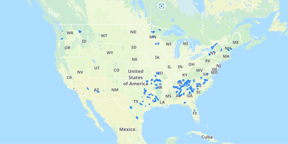
Lake Coverage
Coverage is important whether you fish competitively, live near multiple states, or just like to get out of town and fish now and then. Nobody likes buying multiple cards for multiple fish finders; the cost increases quickly!
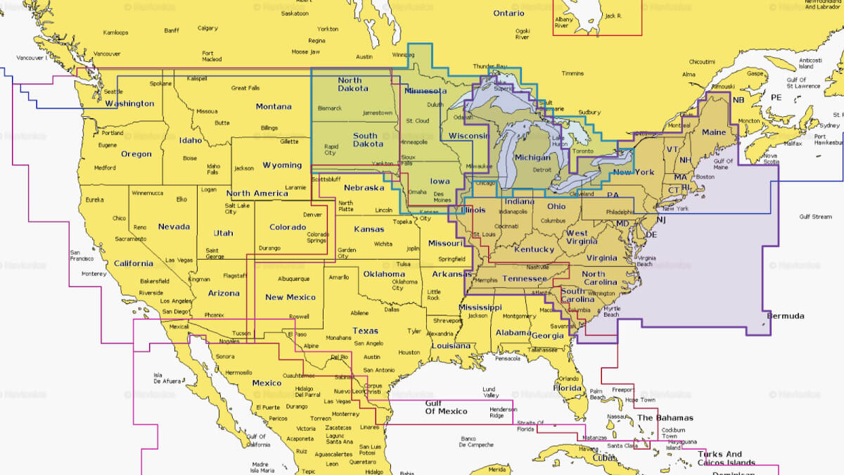
Other considerations when choosing a map card are regional overlaps. You can choose from two regions if you fish in one of these states.
And on the other end of the spectrum, if you fish Minnesota or Wisconsin, you only get a single state with LakeMaster. These two states have the most lakes covered by far, but it’s a bummer they aren’t combined into one regional card.
Best Coverage: Navionics+
Subscriptions, Updates
Here’s the deal, with LakeMaster, you buy the card, and that’s it. No subscription is required to use any features or functions, but you cannot download any updates. You’ll have to buy the new card when a new version of your region is released.
Buying a Navionics Platinum+ chip gives you 1-year access to chart updates and overlay downloads. After that, you can no longer download or use the Satellite and Shaded Relief layers on your fish finder – unless you renew the next year. Bummer.
Advantage: LakeMaster VX
Mobile Apps
The mobile apps are related to the mapping chips. They display the same types of information but should be viewed as standalone products. You don’t need one to use the other, but a quick comparison is still helpful.
Humminbird One Boat Network
I’ve had a VX card for a few months and have been playing with the new app. Let me tell you, this is one slick tool!
Anyone can use the app and view the Humminbird Basemap, but when you buy a LakeMaster VX card, you should (at least I did) get a coupon code to download any area of the US and Canada to your mobile device. It’s good for 1 year and then $24.99 yearly.
You can view charts, set depth highlights, apply Shaded Relief, overlay Aerial Imagery, set waypoints, and more. It’s an absolute killer app for studying on the go, whether traveling or riding in someone else’s boat.
Navionics Boating
Unlike the One Boat Network app, I didn’t get a 1-year voucher for buying a Navionics Platinum+ card. To use Navionics charts and overlays, you have to make another purchase of $24.99
It’s still a good deal. You get access to the charts, updates, Satellite Images, SonarChart Shading, Shaded Relief, and Sonar Imagery for the entire US & Canada.
Best App: LakeMaster (One Boat Network)
Which Map Card Should You Buy?
Having spent time with both products on my boat, I highly recommend the LakeMaster VX and VX Premium over the Navionics+ or Platinum+ for a primary mapping chip.
In addition to the high-def contours (and being far easier to use) – the ability to highlight depth ranges, change color palettes, overlay Aerial Imagery, and turn on 2D Shaded Relief for ALL lakes – without a subscription makes the VX maps big winners for Humminbird users.
Yes, Navionics covers more lakes and has similar features, but that’s not everything. Many of those lakes have basic 5-foot contours, but so does the Humminbird Basemap. If you live in MN or WI or a state where Navionics+ offers more or different coverage, that’s a good alternative way to go.
I plan to continue using the LakeMaster VX on the console and eventually upgrade the card on the bow. But I will also keep the Platinum+ card as a secondary map for when I travel outside my usual areas to fish.
*Last updated 2026-06-19 at 06:56 / Product Links & Images from Amazon Product Advertising API
Leave a reply